Meeting with the UK Geospatial Commission
State Service of Ukraine for Geodesy, Cartografy and Cadastre launched collaboration with Geospatial Comission of the UK.
The Geospatial Commission was established in 2018 as an independent, expert committee, within the Cabinet Office, responsible for setting the UK’s geospatial strategy and coordinating public sector geospatial activity. In February 2023, following a machinery of government change, the Geospatial Commission moved from the Cabinet Office to the newly formed Department for Science, Innovation and Technology.
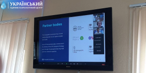
The Geospatial Commission has a formal relationship with six, core ‘partner bodies’ (the Geo6):
British Geological Survey;
Coal Authority;
HM Land Registry;
Ordnance Survey;
UK Hydrographic Office;
Valuation Office Agency.
Joint online seminar with the representatives of Geospatial Comission was held on 21 of June 2023. During seminar participants considered the following issues:
- Activity of the Geospatial Comission;
- UK Geospatial Strategy;
- Collaboration between public and private sectors in UK in the area of geospatial information;
- Geospatial data use case examples: on example of cooperation between Ordnance Survey and UK Health Security Agency) and during emergencies;
- Geospatial data use case examples: extreme heat and flooding examples;
- Usage geospatial information in the defence sector with restrictions in privacy and Operation Security ( OPSEC).
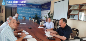
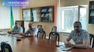
The following representatives of Ukrainian Hydrometeorological Center participated in the event:
- Yuriy Burlaka - deputy director;
- Veronika Filonenko - head of the system of observations and hydrometeorological support department;
- Ruslan Reviakin - head of internationa lcooperation department.